
- City of LF ‘Your Health Matters’ Program Recognizes Participants
- South Texas Students Meet Accordion Music Icons Los Tigres Del Norte In Edinburg Thanks To Khs America/Hohner Alianza Académica Initiative
- Fragile Planet Offers a Nighttime Wildlife Experience
- Falcons Soccer Off & Running
- Cameron County Receives Funds to Improve Two Parks
- Falcons Complete First Half of 32-6A
- School District to Help out Victims of California Wildfires
- Sand Castle Days Continued Despite Unexpected Weather
- Ready for District
- Discussion of Garbage Dumpster Rates, Agreements Between State & City on Highway Regulations, and More
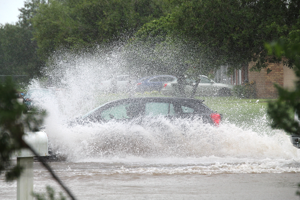
Forecasters warn Valley residents to keep an eye on the tropics
- Updated: August 27, 2020
By TONY VINDELL
LFN
It seems that forecasting the weather is as uncertain as who is going to win this year’s presidential election.
One day it calls for a sunny, hot and dry day, while the next time the prediction is for rain but no trace of precipitation comes down from the sky.
It also seems that this year there has been more rain than the previous year for Cameron County.
But in reality there is a half an inch difference of precipitation that has fallen in the Brownsville/Los Fresnos area.
According to statistics provided by the National Weather Service office in Brownsville, 14.10 inches of rainfall has been recorded in the area so far this year, compared to 13.60 inches during the same period a year ago.
“The Brownsville/Los Fresnos area is a little above normal,” Brian Mejia, a NWS forecaster said. “However, Hidalgo County has received more rainfall.”
A hurricane season plays a big role in how much precipitation a place gets and that depends how a season turns out.
This year, for example, it has been upgraded initially from seven to 11 named hurricanes to 15 to 25.
Hurricane Hanna, which brought 10 or more inches of rain to some parts of the Rio Grande Valley, is only the first of the seven named storms so far this hurricane season.
Mejia said September is the peak season for hurricanes, so there still is plenty of time to see more rain coming down.
The average rain in this area is 28 inches per year, but that could change now that the threat of two storms is on the horizon, one east of the Caribbean.
RGV residents should be prepared for the worse because from now on until the end of September the hurricane season reaches its peak.